Weather report issued by The Marine Meteorological Center Split on 24.01.2021 at 12
Warning
In the South and Central Adriatic gusts of SE and S winds increasing to 35-60 knots whereas already late in the day first in the North and in a part of the Central Adriatic gusts of N and NW winds, along the coast also of NE 35-60 knots are expected but will be gradually decreasing already in the second part of the night and in the morning turning to SW and SE winds 35-40 knots. The sea locally 5, at night also 6 in the open of the South and of a part of the Central Adriatic, tomorrow gradually calming first in northern, then also in the central part. Isolated thunderstorms.
Synopsis
The low with a frontal disturbance is approaching from the west and will be shifting fast across the Adriatic to the east but a new one is expected already tomorrow.
Weather forecast for the Adriatic for the first 12 hours
SE and S winds 10-20, in the Central and South Adriatic increasing fast to 18-38 knots and already in the afternoon first in the North Adriatic, in the evening also southwards turning to N and NW winds, along the coast also to NE wind 16-32 knots. The sea 3-4 whereas 4-5 in the open of the Central and South Adriatic and in the evening also in the North Adriatic. Visibility 5-15 km. Mostly cloudy with scattered rain and rain showers with thunder and a risk of wind drifted snow in northern part.
Weather forecast for the next 12 hours
Strong to gale force N and NW winds, along the coast also NE wind, in the second part of the night decreasing first in the North Adriatic where will be again turning to moderate to strong SE and SW winds. The sea moderate, in the open also rough, in the South and in a part of the Central Adriatic very rough as well. Cloudy with scattered rain and rain showers with thunder and a risk of wind drifted snow in northern part whereas in the second part of the night temporary clearing up, first in the North Adriatic.
PMC - Split
Douglas scale
| State of the sea | Description | Waves average height (m) |
|---|---|---|
| 0 | calm (glassy) | 0 |
| 1 | calm (rippled) | 0 - 0.1 |
| 2 | smooth | 0.1 - 0.5 |
| 3 | slight | 0.5 - 1.2 |
| 4 | moderate | 1.25 - 2.5 |
| 5 | rough | 2.5 - 4 |
| 6 | very rough | 4 - 6 |
| 7 | high | 6 - 9 |
| 8 | very high | 9 - 14 |
| 9 | phenomenal | > 14 |
Beaufort scale
| Wind speed | Waves height | ||||||
|---|---|---|---|---|---|---|---|
| km/h | m/s | kt | mph | m | ft | ||
| 0 Bf | calm | < 1 | 0 - 0.2 | < 1 | < 1 | - | - |
| 1 Bf | light air | 1 - 5 | 0.3 - 1.5 | 1 - 3 | 1-3 | 0.1 (0.1) | 0.25 (0.25) |
| 2 Bf | light breeze | 6 - 11 | 1.6 - 3.3 | 4 - 6 | 4 - 7 | 0.2 (0.3) | 0.5 (1) |
| 3 Bf | gentle breeze | 12 - 19 | 3.4 - 5.4 | 7 - 10 | 8 - 12 | 0.6 (1) | 2 (3) |
| 4 Bf | moderate breeze | 20 - 28 | 5.5 - 7.9 | 11 - 16 | 13 - 18 | 1 (1.5) | 3.5 (5) |
| 5 Bf | fresh breeze | 29 - 38 | 8.0 - 10.7 | 17 - 21 | 19 - 24 | 2 (2.5) | 6 (8.5) |
| 6 Bf | strong breeze | 39 - 49 | 10.8 - 13.8 | 22 - 27 | 25 - 31 | 3 (4) | 9.5 (13) |
| 7 Bf | near gale | 50 - 61 | 13.9 - 17.1 | 28 - 33 | 32 - 38 | 4 (5.5) | 13.5 (19) |
| 8 Bf | gale | 62 - 74 | 17.2 - 20.7 | 34 - 40 | 39 - 46 | 5.5 (7.5) | 18 (25) |
| 9 Bf | strong gale | 75 - 88 | 20.8 - 24.4 | 41 - 47 | 47 - 54 | 7 (10) | 23 (32) |
| 10 Bf | storm | 89 - 102 | 24.5 - 28.4 | 48 - 55 | 55 - 63 | 9 (12.5) | 29 (41) |
| 11 Bf | violent storm | 103 - 117 | 28.5 - 32.6 | 56 - 63 | 64 - 72 | 11.5 (16) | 37 (52) |
| 12 Bf | hurricane | >= 118 | >= 32.7 | >= 64 | >= 73 | 14 (-) | 45 (-) |
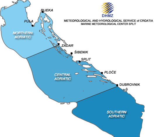
Adriatic sub-basins