Weather report issued by The Marine Meteorological Center Split on 25.12.2020 at 06
Warning
LOCAL GUSTS OF SE and SW WINDS 35-40 KNOTS. IN THE NORTH ADRIATIC FROM MIDDAY AND IN A PART OF THE CENTRAL ADRIATIC LATE IN THE NIGHT, GUSTS OF NE WINDS STRENGTHENING TO 35-65, IN THE VELEBIT CHANNEL UP TO 85 KNOTS. IN THE NORTH ADRIATIC LATE IN THE DAY AND IN A PART OF THE CENTRAL FROM THE MIDDLE OF THE NIGHT, SEA UP TO 5. ISOLATED THUNDERSTORMS. STILL A CHANCE OF FOG PATCHES IN THE FAR NORTH OF THE ADRIATIC AT FIRST.
Synopsis
The frontal system associated with the newborn cyclone in the Gulf of Genoa is slowly shifting across the Adriatic southeastwards, while the ridge of high pressure is intensifying behind.
Weather forecast for the Adriatic for the first 12 hours
SE and SW winds 12-26, turning toward midday, firstly in the far north, then in the rest of the North Adriatic, to NE, and strengthening to 16-32, in the Velebit Channel up to 38 knots. Sea increasing to 3-4, in the North Adriatic late in the day to 4-5. Visibility 10-20, in places reduced to around 4 km due to mist, and in the far north of the Adriatic at first possibly to less than 1 km due to fog. Variably cloudy with scattered rain, isolated rain showers and thunder, in the Velebit Channel toward the end of the day with a chance of a little snow.
Weather forecast for the next 12 hours
Variably cloudy with scattered rain, isolated rain showers and thunder, in the Velebit Channel with a chance of a little snow. Moderate to strong SE and SW winds, turning in the North, then in a part of the Central Adriatic, to strong and gale force, in the Velebit Channel up to storm force NE winds. Sea slight and moderate, in the North, from the middle of the night in a part of the Central Adriatic, moderate and rough.
PMC - Split
Douglas scale
| State of the sea | Description | Waves average height (m) |
|---|---|---|
| 0 | calm (glassy) | 0 |
| 1 | calm (rippled) | 0 - 0.1 |
| 2 | smooth | 0.1 - 0.5 |
| 3 | slight | 0.5 - 1.2 |
| 4 | moderate | 1.25 - 2.5 |
| 5 | rough | 2.5 - 4 |
| 6 | very rough | 4 - 6 |
| 7 | high | 6 - 9 |
| 8 | very high | 9 - 14 |
| 9 | phenomenal | > 14 |
Beaufort scale
| Wind speed | Waves height | ||||||
|---|---|---|---|---|---|---|---|
| km/h | m/s | kt | mph | m | ft | ||
| 0 Bf | calm | < 1 | 0 - 0.2 | < 1 | < 1 | - | - |
| 1 Bf | light air | 1 - 5 | 0.3 - 1.5 | 1 - 3 | 1-3 | 0.1 (0.1) | 0.25 (0.25) |
| 2 Bf | light breeze | 6 - 11 | 1.6 - 3.3 | 4 - 6 | 4 - 7 | 0.2 (0.3) | 0.5 (1) |
| 3 Bf | gentle breeze | 12 - 19 | 3.4 - 5.4 | 7 - 10 | 8 - 12 | 0.6 (1) | 2 (3) |
| 4 Bf | moderate breeze | 20 - 28 | 5.5 - 7.9 | 11 - 16 | 13 - 18 | 1 (1.5) | 3.5 (5) |
| 5 Bf | fresh breeze | 29 - 38 | 8.0 - 10.7 | 17 - 21 | 19 - 24 | 2 (2.5) | 6 (8.5) |
| 6 Bf | strong breeze | 39 - 49 | 10.8 - 13.8 | 22 - 27 | 25 - 31 | 3 (4) | 9.5 (13) |
| 7 Bf | near gale | 50 - 61 | 13.9 - 17.1 | 28 - 33 | 32 - 38 | 4 (5.5) | 13.5 (19) |
| 8 Bf | gale | 62 - 74 | 17.2 - 20.7 | 34 - 40 | 39 - 46 | 5.5 (7.5) | 18 (25) |
| 9 Bf | strong gale | 75 - 88 | 20.8 - 24.4 | 41 - 47 | 47 - 54 | 7 (10) | 23 (32) |
| 10 Bf | storm | 89 - 102 | 24.5 - 28.4 | 48 - 55 | 55 - 63 | 9 (12.5) | 29 (41) |
| 11 Bf | violent storm | 103 - 117 | 28.5 - 32.6 | 56 - 63 | 64 - 72 | 11.5 (16) | 37 (52) |
| 12 Bf | hurricane | >= 118 | >= 32.7 | >= 64 | >= 73 | 14 (-) | 45 (-) |
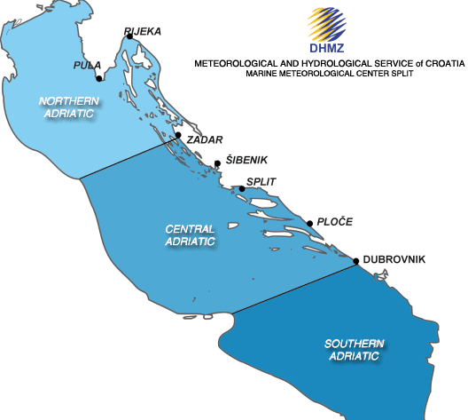
Adriatic sub-basins